// 03 RESTRICTED
raindrive
Plan a long drive around the weather you will actually hit. Give it a start, an end, the stops and when you leave; it works out when you reach each stretch of road, looks up the forecast for that place at that hour, and colours the route and a timeline by how bad the driving will be. Then move a stop, lengthen a stay or leave later and the weather moves with you, instantly: routes ignore the clock and every forecast covers sixteen days, so each what-if is arithmetic, not a fetch. Three clients give one answer — a web app on Leaflet, a SwiftUI iPhone app on Apple Maps, and a Kotlin Android app — with the planning math ported line for line and tests that hold all three to the same results. On the trip below, all three call the same stretch Rough: gusts to 45 mph near Baker City, Oregon. Forecasts from Open-Meteo; routes from OSRM, Google or Apple Maps; town names from GeoNames, bundled.
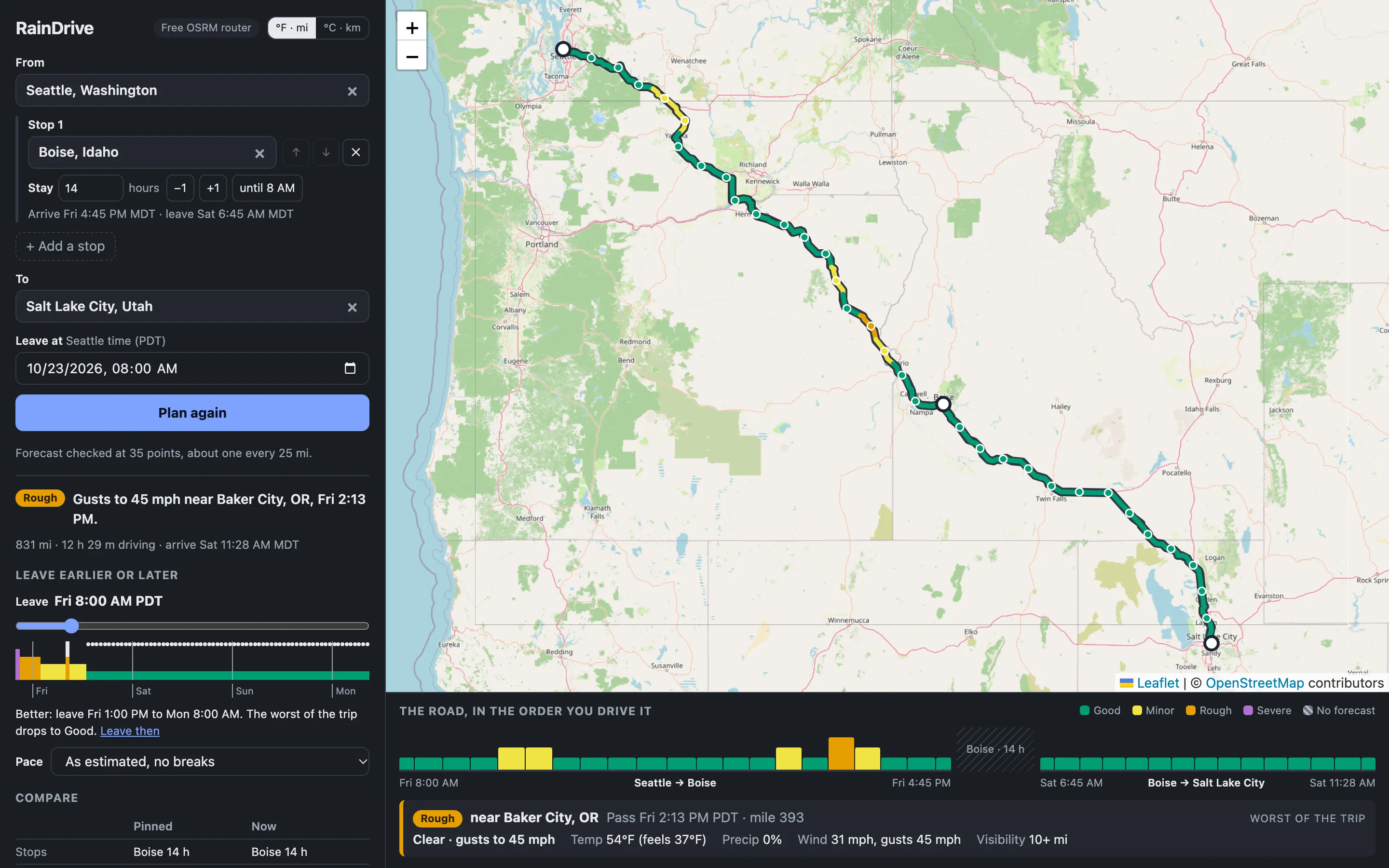 01 Seattle to Salt Lake, via Boise
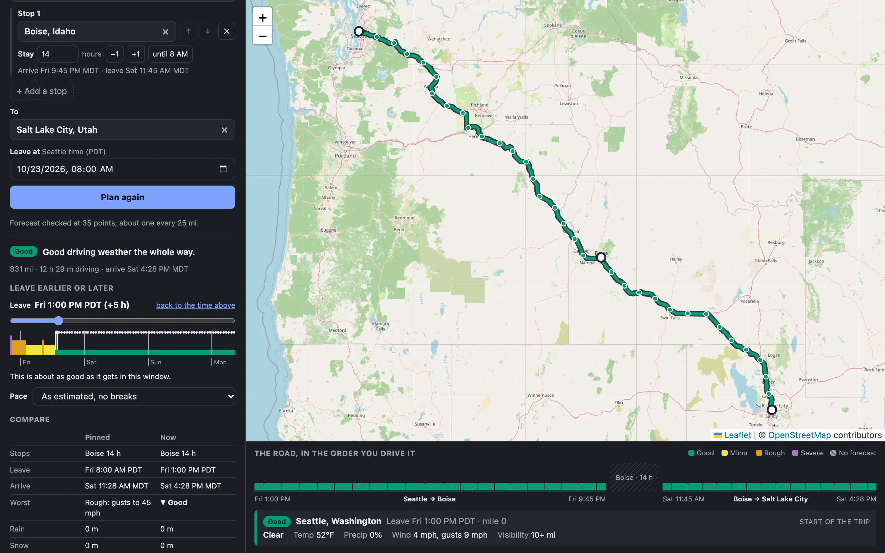 02 Leave five hours later: all Good
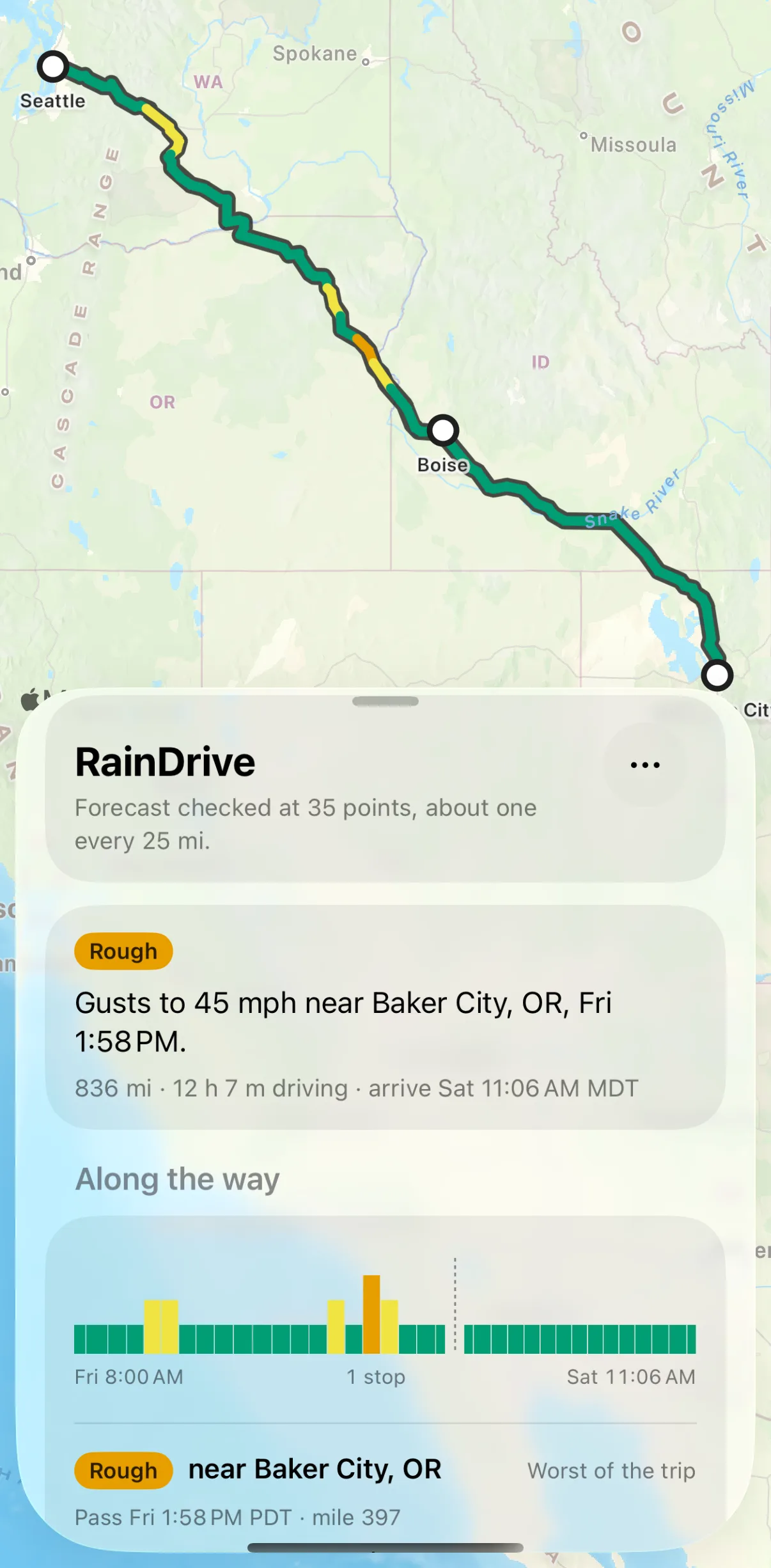 03 iPhone, on Apple Maps
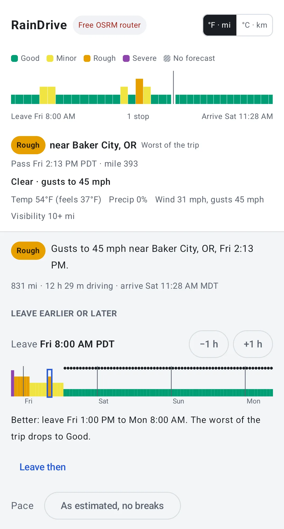 04 Android, same answer
Why the what-ifs are free
Routes are traffic-unaware on purpose and every forecast fetched covers sixteen days, so once a trip is loaded, moving a stop, lengthening a stay, changing the pace or leaving at a different hour is arithmetic in the browser with no network at all. Only changing a city costs a request — one route, one forecast, both cached.
The severity ladder
- Minor — light rain, drizzle, light snow, fog, gusts from 31 mph, or a 50% chance of precipitation.
- Rough — rain, snow, gusts from 43 mph, visibility under 0.6 mi, or rain at or below freezing.
- Severe — freezing rain, heavy snow, thunderstorms, gusts from 56 mph, or visibility under 0.3 mi.
“No forecast” is its own hatched state: a stretch the forecast does not reach is never drawn as clear.
Deciding when to leave
A strip under the departure slider shows the worst conditions of the whole trip for every hour you could set off, from twelve hours before to seventy-two after, with dots on the good ones. The first plan is pinned and every change after it is shown alongside — worst conditions, hours of rain and snow, arrival — and the address bar always holds the whole trip, so a link reproduces it exactly.